China 12:55, 01-Oct-2022
From south to north, China has seven major rivers, vertically and horizontally: the Songhua, Liaohe, Haihe, Yellow, Huaihe, Yangtze and Pearl rivers. They can be categorized as exterior and interior systems. The drainage area for the exterior rivers that empty into the oceans accounts for over 60 percent of the country's total land area.

Facts behind the seven major rivers
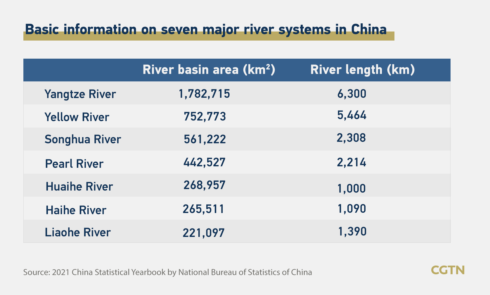
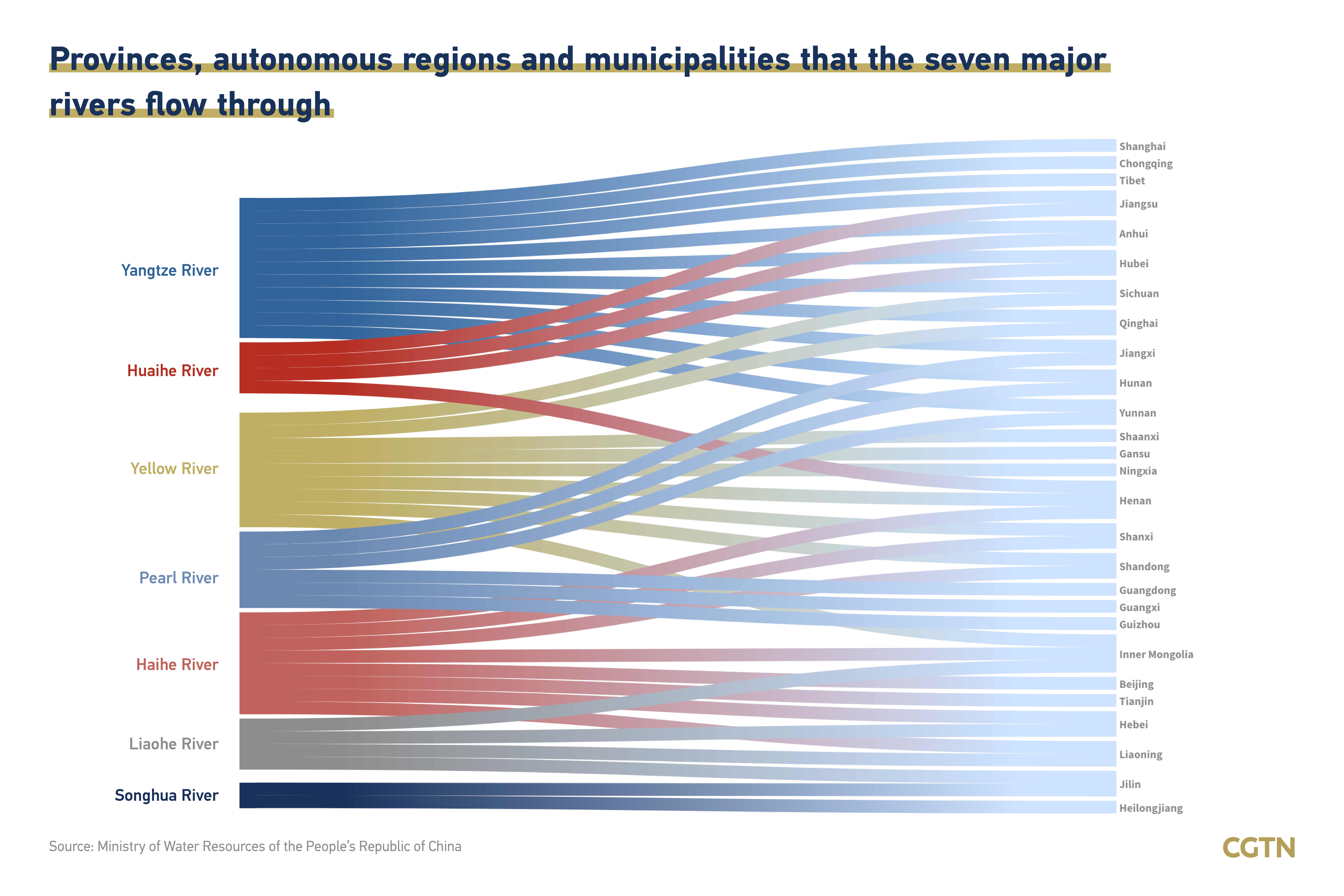
Revered as the "mother river" of the Chinese nation, the Yangtze is the country's longest river, at 6,300 kilometers. The main stream of the Yangtze River flows through 11 provinces, autonomous regions and municipalities, with a basin area of nearly 1.8 million square kilometers. Among the world's rivers, the Yangtze ranks third after the Nile in Africa and the Amazon in South America.
The Yellow River is the second longest river in China and the world's sixth-longest, with a length of about 5,464 kilometers, flowing through nine provinces and autonomous regions in China.

The Songhua River has a total length of 2,308 kilometers and spans two provinces, Jilin and Heilongjiang. Its basin area of 561,222 square kilometers accounts for 60 percent of the total area of northeast China. The Pearl River is the fourth largest in China, with a total length of 2,214 kilometers. It covers six provinces, autonomous regions and municipalities on the Chinese mainland.
The Huaihe River, located between the Yangtze and Yellow rivers, flows through central China and has a total length of around 1,000 kilometers. The Haihe River has the largest river system in northern China, covering eight provinces, autonomous regions and municipalities. The Liaohe River, located in northeastern China, has a total length of 1,390 kilometers, spanning four provinces and autonomous regions.
Social development
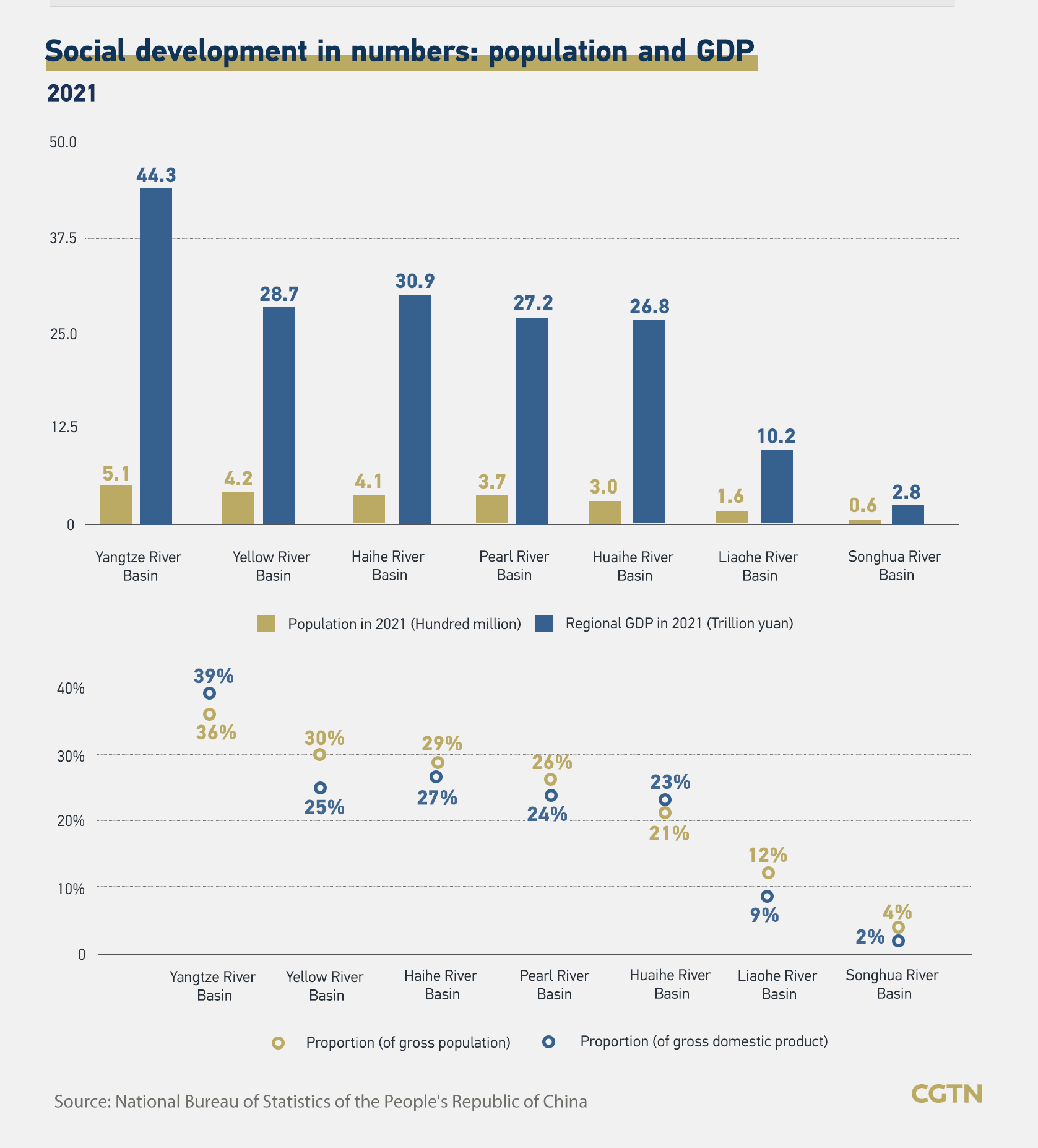
The Yangtze River plays a central role in Chinese agriculture, industry and transportation. It is the country's primary waterway, and 36 percent of China's population lives in its basin. In 2021, the gross domestic product (GDP) generated in the Yangtze River Basin approached 44.3 trillion yuan ($6.9 trillion), accounting for 39 percent of the country's GDP, according to the National Bureau of Statistics of China.
The Yellow River Basin is also a key agricultural and industrial region, accounting for 30 percent of China's population and generating 25 percent of the country's GDP in 2021.

People living in the Haihe River Basin accounted for 29 percent of China's population and created 27 percent of the country's GDP in 2021. The Pearl River is an extensive river in southern China. More than one-quarter of the Chinese people live in the Pearl River Basin.
The Huaihe, Liaohe and Songhua rivers also play essential roles in agricultural and industry. In 2021, provinces, autonomous regions and municipalities in the Huaihe, Liaohe, and Songhua river basins generated 23 percent, 9 percent and 2 percent respectively of the country's GDP.
Economic development

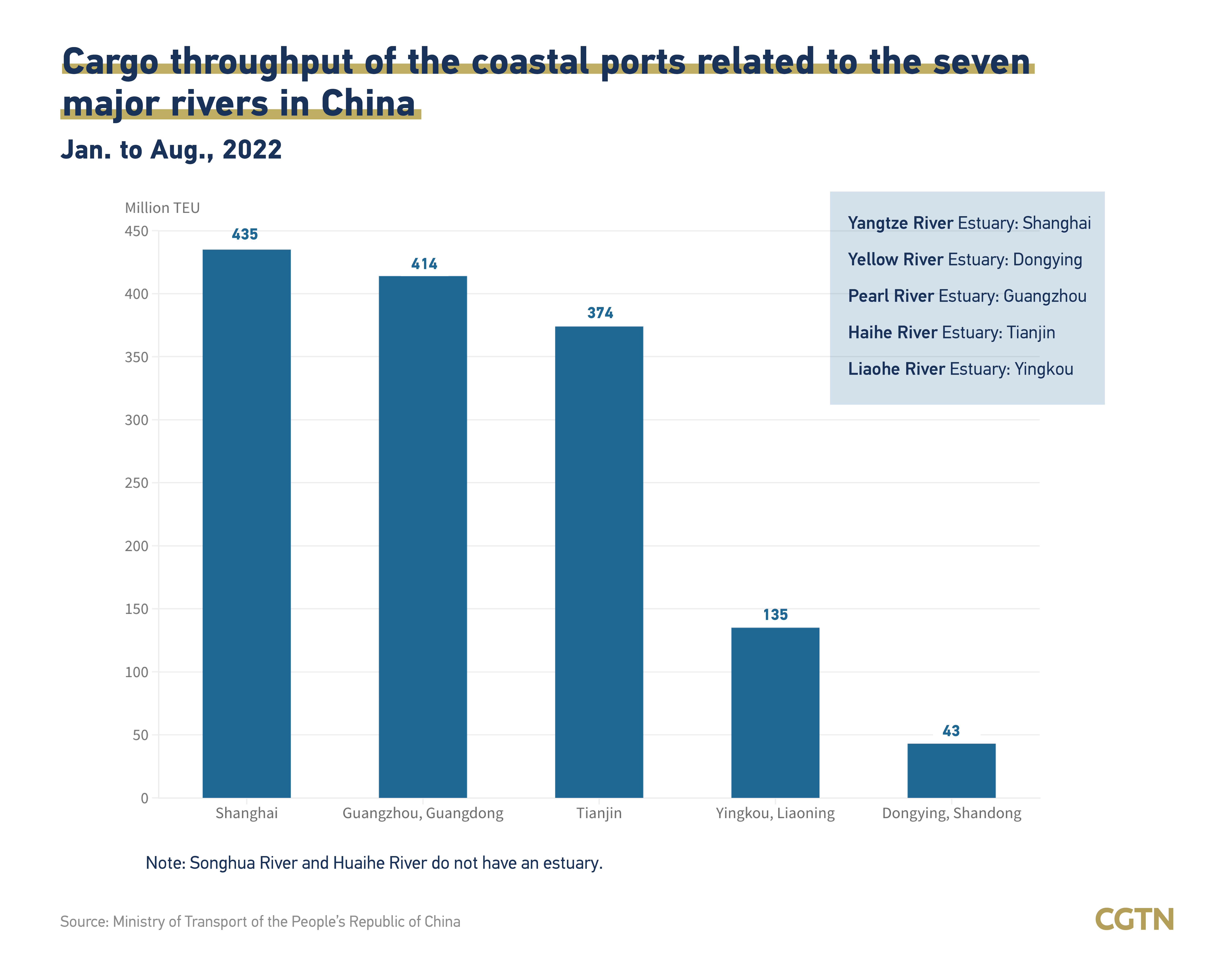
Among the seven rivers mentioned above, the Huaihe River and the Songhua River do not have an estuary. The estuary of the Yangtze River is located in Shanghai. The cumulative cargo throughput of the Shanghai port from January to August this year was 438 million Twenty-foot Equivalent Units (TEU). The Yellow River eventually flows into the sea near the city of Dongying in Shandong Province, and the cumulative cargo throughput of the Dongying port in the first eight months of the year was 43 million TEU. The cumulative cargo throughput of Guangzhou, Tianjin and Yingkou ports from January to August this year was 414, 374, and 135 million TEU, respectively.
Read more:
The Great Rivers of China: The Yangtze River


Nenhum comentário:
Postar um comentário